Mountain bike trails

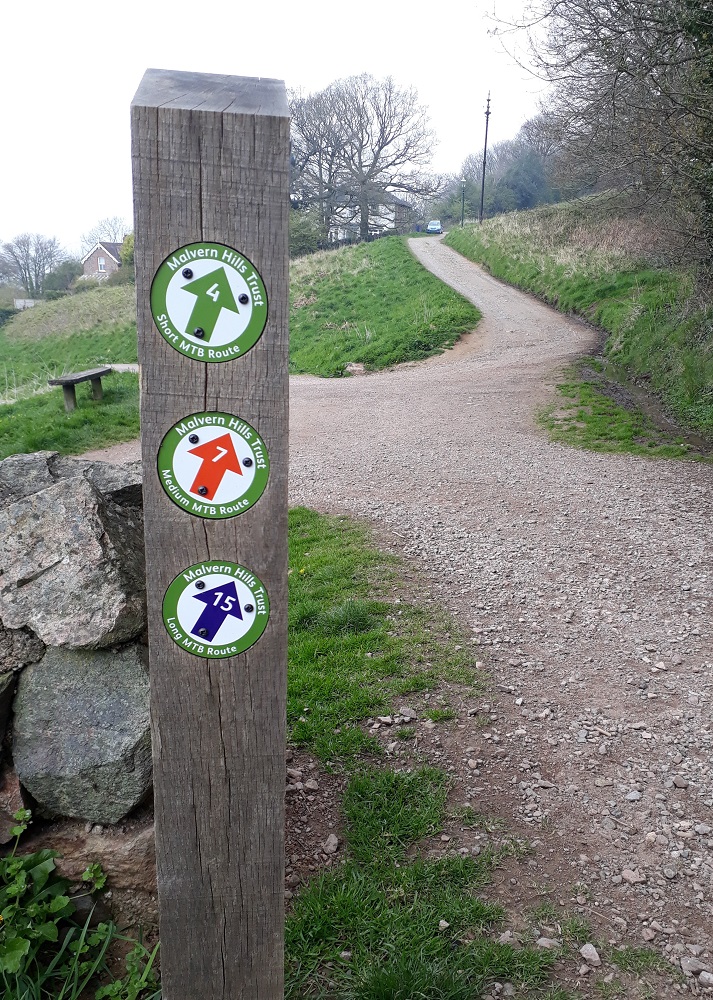
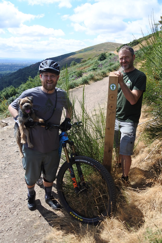
A series of signposted mountain biking trails can now be found on the Malvern Hills.  These easy to follow routes form part of our Malvern by Mountain Bike project to help cyclists find their way around this iconic landscape.

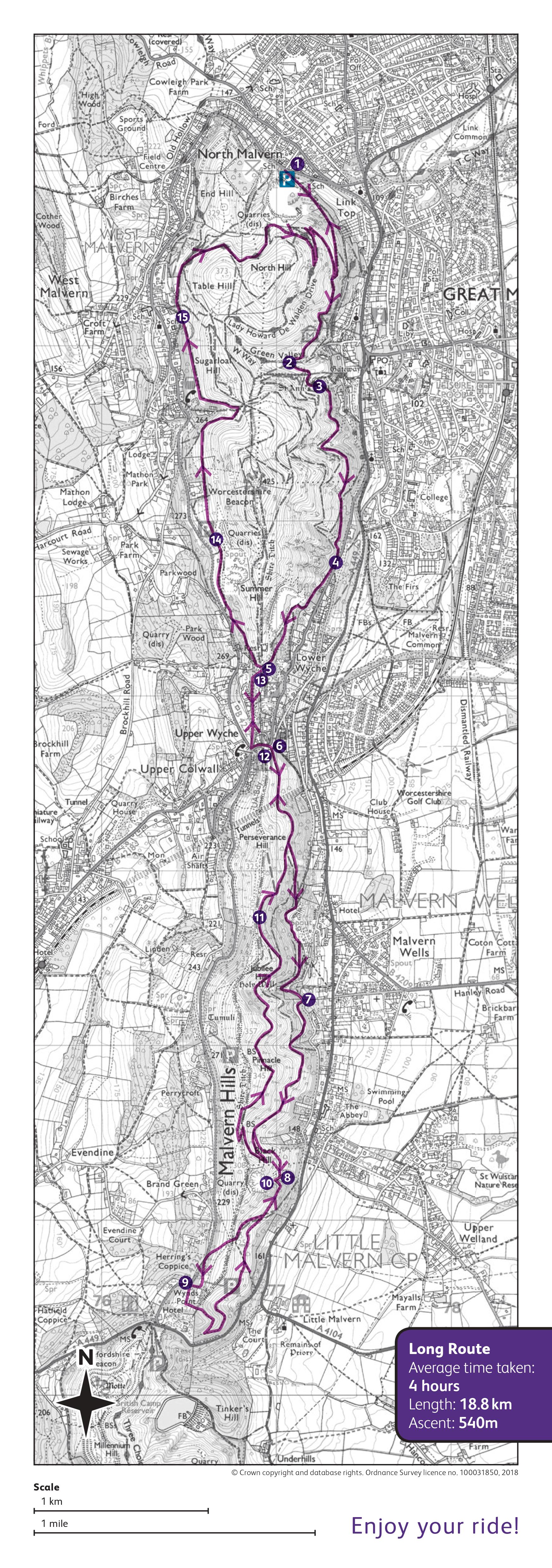
Short descriptions of the three routes can be found below, along with downloadable maps and GPX files to assist (although the route can be followed by using the waymarker arrows alone).  Paper copies of the maps are available from our offices, local Tourist Information Centres, local bike shops and cafes.

When downloading the .gpx files it is recommended that you right click the link and 'save file' to your device which allows you to ensure that the file is in the correct .gpx format.

If you wish to explore further, check out our Walking and Cycling Map and Guide which highlights the cycling access (bridleways and permissive cycle paths) on the Malvern Hills and Commons.

Please be aware that these trails are shared with walkers and horse riders.  See our cycling code below with tips on how to have a safe and enjoyable ride.


Short Route

As the name suggests, this is the shortest of our three signposted routes around the Malvern Hills.

Starting at North Quarry car park, this 5.6km route climbs quickly up to Lady Howard De Walden Drive.  Ride along this sweeping path that circuits both North Hill and Table Hill offering fantastic views across Herefordshire and Worcestershire before a descent down to your start point. 

You'll be racking up about 206m of climbing over this short route.

To accompany the green arrows along the signposted route we've put together a Route Card with directions (and where you might find refreshments...) and a GPX file for those who use a smartphone or bike computer.

Download Short Route Card (PDF)
Download Short Route Map (GPX)


Medium Route

The Medium Route takes in a circuit of the northern section of the Malvern Hills for a ride totalling 8.7km.

You'll travel along wide Victorian paths through woodlands and past the historic St Ann's Well before climbing up to the Gold Mine.  Here, you can leave the trail and follow the main surfaced path up to the highest point on the Malvern Hills, the Worcestershire Beacon.  Returning to the trail, ride around the western side of the Worcestershire Beacon with fantastic views towards Wales (if you pick a sunny day) before looping round to your start point.

Appreciate the views along many of the flatter paths on the Hills and you'll climb about 260m on this ride.

To accompany the orange arrows along the signposted route we've put together a Route Card with directions (and where you might find refreshments...) and a GPX file for those who use a smartphone or bike computer.

Download Medium Route Card (PDF)
Download Medium Route Map (GPX)


Long Route

It's here!  The Long Route has been launched and you can now follow this signposted route for almost 19km around the Malvern Hills.

The beginning of the ride follows the direction of the Medium Route before splitting off at the Gold Mine to continue southwards.  Winding through scenic woodlands you'll pass though the imposing Berrington Quarry before a steep climb to the ridgeline at Black Hill.  Take in the view before descending to loop around Black Hill car park (refreshments and facilities at British Camp are a short 350 metre road ride away from here).

Begin the route back northwards along familiar trails and before ascending the slope of Pinnacle Hill with stunning 360 views.  The route continues along wooded trails before rejoining the Medium Route back to your start point.

You'll clock 540 metres of climbing on this route.

Download Long Route Card (PDF)
Download Long Route Map (GPX)


Cycling code

The Hills and Commons are a shared landscape with hundreds of thousands of visitors each year with many nationally protected habitats and archaeology.  

Please help us to look after the Hills and Commons for the future by following the following tips.

  • Please only cycle on bridleways.  It is illegal to cycle on the footpaths
  • Please do not ride on archaeological monuments including the British Camp, Shire Ditch and Midsummer Hill
  • Always give way to walkers and horse riders
  • Be courteous and patient with other path users who may be moving more slowly than you
  • Cycle at a sensible speed
  • Be particularly careful at junctions, bend or other blind spots where people could appear without warning
  • Carry a bell and use it, or call out to avoid surprising people.  Don't assume people can see and hear you
  • The Hills can be busy at weekends and bank holiday and you may enjoy your ride more by cycling outside the busiest periods

About our trails

Our trails are not graded for difficulty, and depending on your skill level, there may be times when you wish to dismount.

The trails follow bridleways and permissive cycle paths on the Malvern Hills.

Mountain bikes are not restricted to these trails but are welcome to explore the bridleways and permissive paths that cross this landscape.  Take a look at our Walking and Cycling Map and Guide to plan your ride if you'd like to explore somewhere new.

All the trails start from North Quarry car park (pay and display) and your contribution goes towards the conservation of the Hills, including paths for visitor access.
However, you can start your ride at any point along the route.

These trails are part of our Malverns by Mountain Bike project to help cyclists find their way around the Malvern Hills and Commons and help us to care and protect this landscape.

Follow us on Facebook and Twitter for updates on the project.